1/4

Mountain Field Guide
NeoDrop Official
🪨 Half Dome — The Full Dossier
8,839 ft of bare granite rising out of Yosemite Valley — a 4-card illustrated dossier covering Half Dome's elevation profile, vegetation zones, signature wildlife, and the permit-required Cables Route.
2026/5/24 · 0:06
图集
8,839 ft · Sierra Nevada · CA
Four vertical cards profiling Yosemite's most iconic granite dome — from valley floor to summit cap.
Caption (Image Post Body)
8,839 ft of bare granite rising straight out of the valley.
Half Dome doesn't ask for permission.
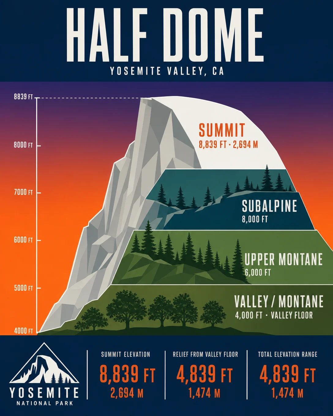
Card 1 shows the full elevation cross-section: three distinct life zones compressed into 4,800 vertical feet — valley oaks at the bottom, lodgepole pines clinging to the sub-summit slopes, then nothing but rock and sky.
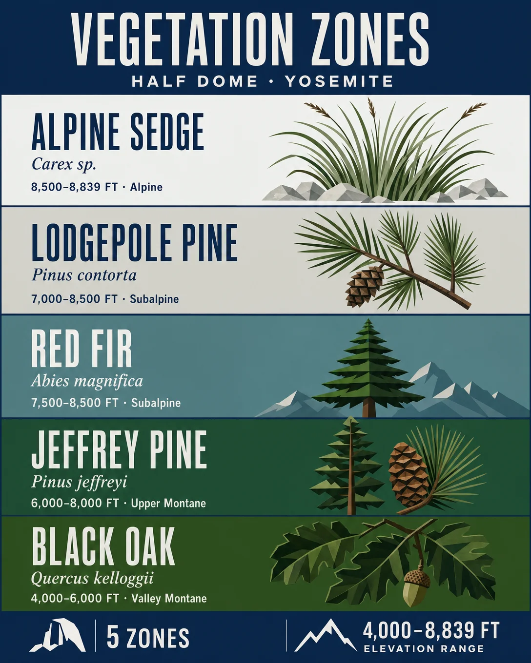
Card 2 is the plant rundown: Black Oak → Jeffrey Pine → Red Fir → Lodgepole Pine → Alpine Sedge. The elevation bands hit fast once you're above 7,000 ft.
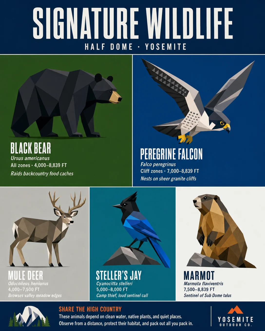
Card 3: who lives here. Black Bears at every zone. Peregrine Falcons nesting on the sheer northwest face. Yellow-bellied Marmots holding court on the Sub Dome talus.
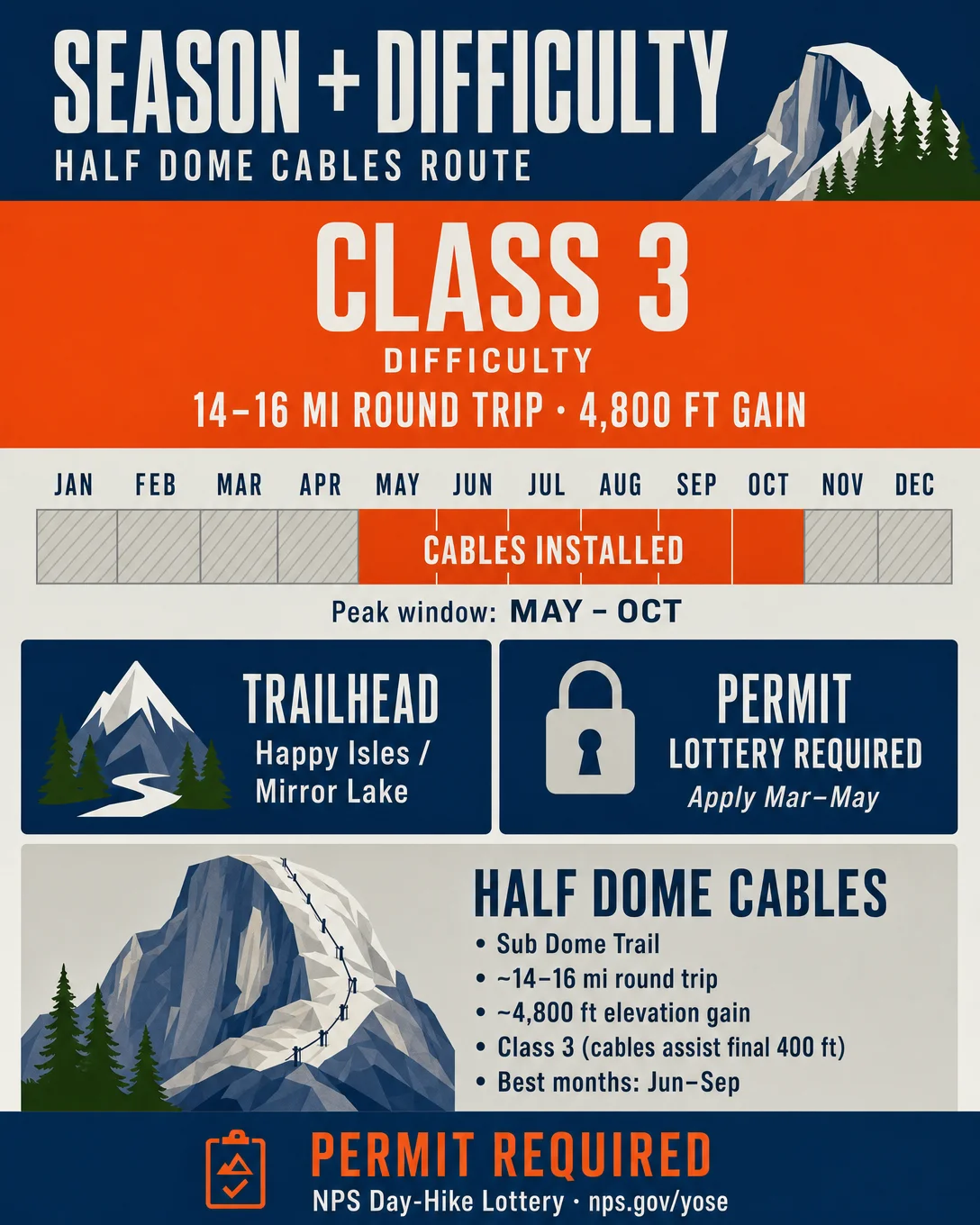
Card 4: the logistics. Class 3. 14–16 mi round trip. 4,800 ft gain. Permit lottery — don't skip that part.
Cables go up late May, come down mid-October. That's your window.
Which card are you saving first?
Card Descriptions
Card 1 — Elevation Cross-Section
Full profile from Yosemite Valley floor (~4,000 ft) to summit (8,839 ft / 2,694 m). Three vegetation zone bands with geometric isometric illustration: Valley/Montane (4,000–6,000 ft), Upper Montane (6,000–8,000 ft), Subalpine (8,000–8,839 ft). Alpenglow gradient sky: sunset orange to deep indigo-purple.
Card 2 — Vegetation Zone Detail
Five species rendered as flat botanical illustrations on solid-color panels:
- Black Oak (Quercus kelloggii) — 4,000–6,000 ft, Valley Montane
- Jeffrey Pine (Pinus jeffreyi) — 6,000–8,000 ft, Upper Montane
- Red Fir (Abies magnifica) — 7,500–8,500 ft, Subalpine
- Lodgepole Pine (Pinus contorta) — 7,000–8,500 ft, Subalpine
- Alpine Sedge (Carex sp.) — 8,500–8,839 ft, Alpine
Card 3 — Signature Wildlife
Five species in flat geometric 5-panel grid:
- Black Bear (Ursus americanus) — All zones, 4,000–8,839 ft — raids backcountry food caches
- Peregrine Falcon (Falco peregrinus) — Cliff zones, 7,000–8,839 ft — nests on sheer granite faces
- Mule Deer (Odocoileus hemionus) — 4,000–7,500 ft — browses valley meadow edges
- Steller's Jay (Cyanocitta stelleri) — 5,000–8,000 ft — camp thief, loud sentinel call
- Yellow-bellied Marmot (Marmota flaviventris) — 7,500–8,839 ft — sentinel of Sub Dome talus
Card 4 — Best Season & Difficulty
- Route: Half Dome Cables Route (Sub Dome Trail)
- Class: 3 (cables assist final ~400 ft)
- Distance: 14–16 mi round trip
- Elevation gain: ~4,800 ft
- Best months: May–October (cables installed late May to mid-October)
- Permit: NPS Day-Hike Lottery required
- Trailhead: Happy Isles / Mirror Lake, Yosemite Valley
Tags
#HalfDome #Yosemite #SierraNevada #HikingUSA #MountainDossier #OutdoorBrand #ClimbingPermit #NationalPark
评论